Pathos and Pleasure. Glenarm to Rathlin 31 August 2024
 |
| The Pleasure |
Yesterday we saw a walking route sign for the International Appalachian Trail. In Glenarm?! In Co Antrim, Norn Iron?! Weird.
This morning we found out what this is all about:
 |
| The International Appalachian Trail (IAT) Ulster Ireland is just one of a growing number of established IAT walking trails stretching across 3 continents which share a common geological heritage - the Appalachian-Caledonian Mountains. These formed more than 250 million years ago during the Paleozoic Era. The trail begins at Slieve League in Donegal, goes east through the Blue Stack Mountains, through Tyrone, and then follows the Ulster Way round the north coast and down to Larne - via Glenarm along the way. Now, where did I put my boots…..? |
Clive has brought to our attention the pathos:
 |
Picture taken from the internet of Madman’s Window. A mile or so south of Glenarm is a geological oddity called Madman’s Window, so called from a tale about a man from Glenarm who lost his sweetheart in the waters of Glenarm Bay. It is said that after this terrible accident, the brokenhearted man, losing his grip on his sanity, visited the rocky hole on a daily basis to stare blankly through the gap and out to sea, apparently waiting for his sweetheart to return. |
We slipped our ropes shortly after 11am to head north towards Rathlin. With the wind behind us and the tide in the same direction, we had a relatively smooth journey. Slightly misty conditions made for some atmospheric views of the headlands along the north Antrim coast.
 |
| Looking towards Waterfoot and Cushendall having just passed Garron Head |
 |
| Torr Head, the closest point of Ireland to Scotland - just 12 miles away. The small building on top of the point, is the ruins of the 1822 Lloyd’s Signal Station for shipping passing through the North Channel. It was one of the first places to use Marconi’s new wireless telegraphy system. |
 |
| Fair Head from the east. |
 |
| Rue Point at the south end of Rathlin, with the light and beacon clearly visible on the left. Look closely and you can also see the East Light of Rathlin just visible on the extreme right of the pic. |
We arrived at the harbour in Church Bay on Rathlin at about 13.30, and found just one free berth on the pontoon, which we tied up to after a rather challenging manoeuvre in winds gusting up to 21 knots. Fortunately there were two men on the pontoon willing and able to take the ropes. We made it safe and sound.
After lunch we walked to Rue Point - about 3 hours round trip. A beautiful walk on a gorgeous afternoon (albeit a little breezy).
 |
| Fair Head from Rue Point on Rathlin. |
 |
| There is a Kelp House at Rue Point, similar to the one in Church Bay - a few details of Kelp Houses are included in my blog for 06 June 2023. Fair Head is in the background. |
 |
| Harbour Seals loafing close to the Kelp House. I managed to count a minimum of 81 animals. |
 |
| At the beacon and light at Rue Point. |
Walked back to Church Bay in time for a pint (or two) in McCuaig’s Bar before dinner aboard (Susie’s korma special). A brilliant day.
The boat bird list was just 20 species and didn’t include anything particularly different. Our Rathlin Island bird list was 33 species, also not including anything unusual.
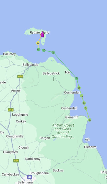
Our route:

What do you call a sleeping bull? A bulldozer! 😊


Comments
Post a Comment